
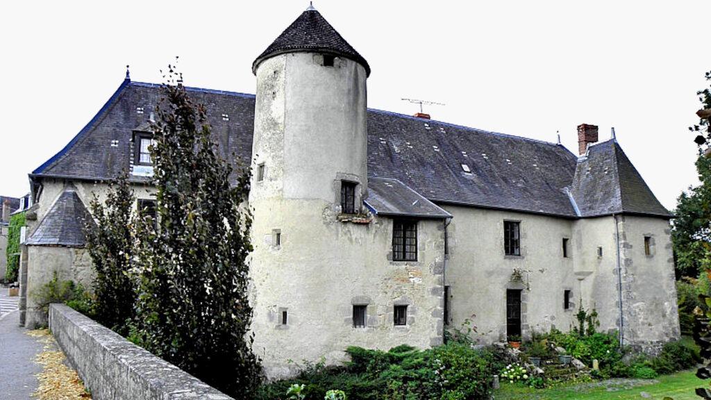
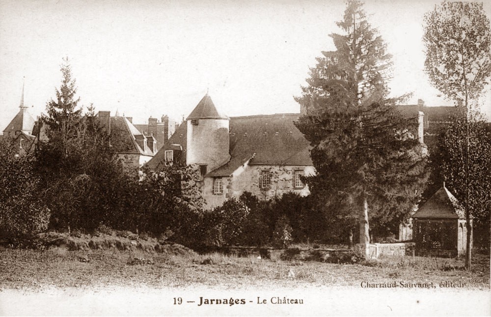
Château de Jarnages is a 15thcentury feudal castle situated in the Creuse, France. In Occitan. Jarnages would have be known as Jarnaja with the s only appearing in the 20th century. Therefore, Château de Jarnages may well appear as Jarnage and Jarnaja on old maps.
The town of Jarnages was fortified in 1434 by Bertrand d’Armagnac, Count of La Marche. These fortifications can still be seen in the (12-15th century) church’s stonework.
Near to the church stand large gate posts and on the road to Gouzon more large fortified gate posts have been incorporated into buildings very close to the road.
Bernard d’Armagnac
In 1438 by order of lieutenant Bernard d’Armagnac and Count de la Marche, various measures such as ditches and fortifications in the towns of Jarnages, Guéret, Ahun, Chénérailles and Felletin.
Bernard d’Armagnac’s father was the king of Sicily.
It was Bernard d’Armagnac that made Jarnages a walled city. During this period, there would have been around 800 inhabitants. Very little apart from the gatekeeper’s house remain.
History of Jarnages
During the Gallo-Roman period Jarnages was known as Agarrusacum. The name Jarnaja comes from an old parish, which was owned by the church. Jarnages or Jarnaja as it was known was founded by the Abbaye Saint Michel de la Cluse, in the diocese of Turin.
Abbaye Saint Michel de la Cluse was founded between 983 & 987 by Hugues de Montboissier le Décousu.
In April 1216 Pope Innocent III (full title: Paypal Bull of Innocent III), confirmed that Abbaye Saint Michel de la Cluse still owned the parish and church of Jarnaja, in addition, Saint-Michel was still the patron saint of the parish. however it was under control of Saint Gervais.
During the 15thcentury, Jarnages was made a Châtellenie (gendarmerie), commanded by Ahun, which was named royal Châtellenie when la Marche was handed over to the crown in 1527.
On June 14, 1686, King Louis XIV exchanged with François III d’Aubusson, Duke of Feuillade, Château de Jarnages, plus, the castles of Felletin, Ahun, Chénérailles, Drouilles and Cervières-en-Forez, for the land and lordship of Saint -Cyr, at Versailles.
In 1764 Jarnages had only 66 chimneys; the number of chimneys being used as an indicating of a village. size. However, in 1785 Jarnages many of the roofs were completely destroyed by fire. Some say this fire was arson. A street now bares the name “rue Brulée” – Burnt road. Le Parlement de Paris passed a ruling forbidding inhabitants of
In 1785 part of Jarnages was destroyed by fire; The street name “rue brulée”, still indicates this. Several years latter, the Parliament of Paris, passed a ruling forbidding the inhabitants of Jarnages to have straw thatched roofs.
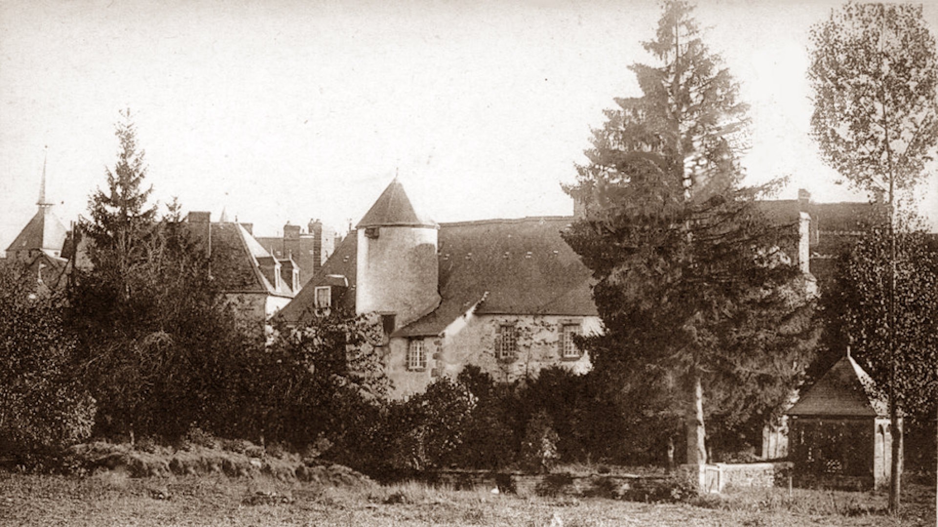
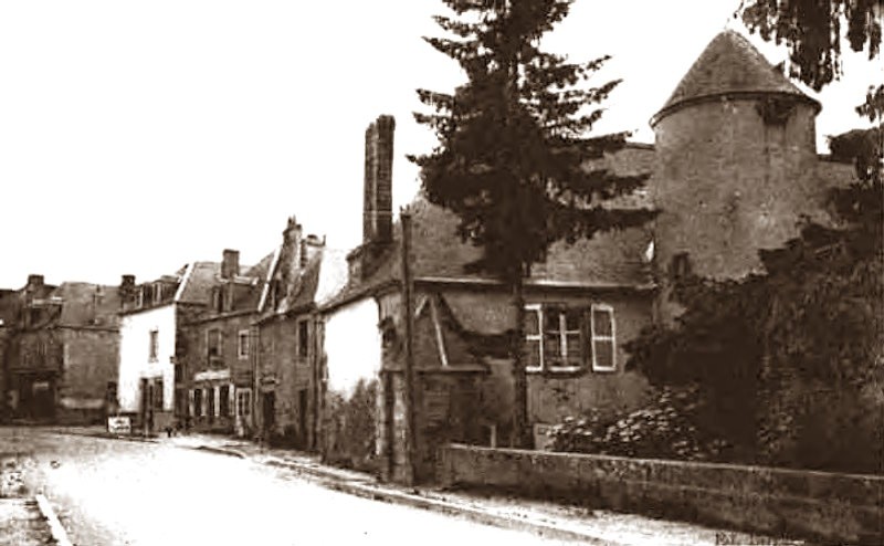
Old Post Cards

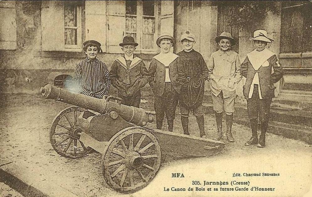
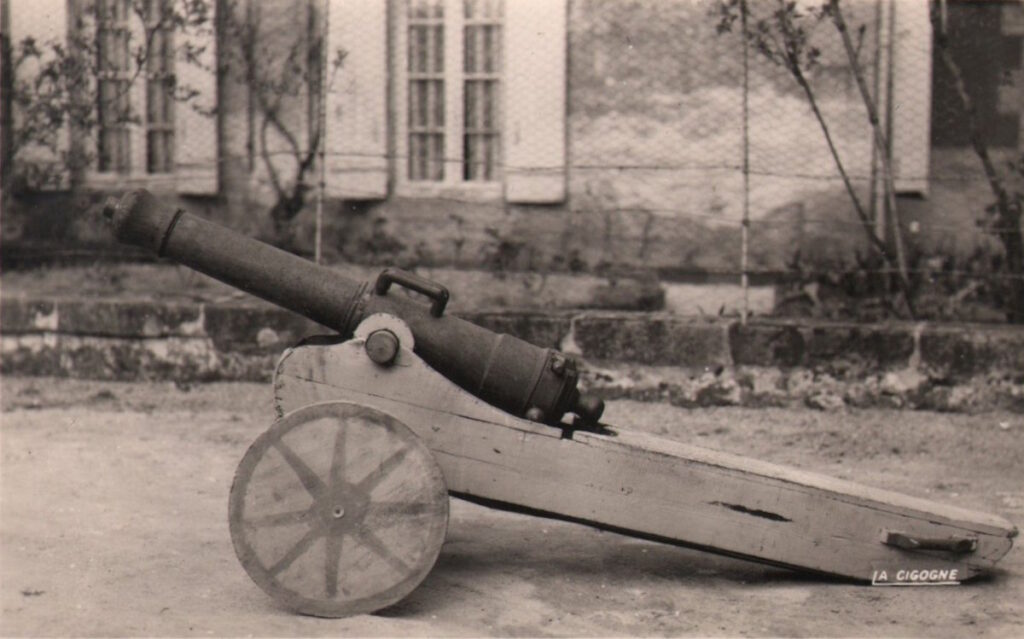
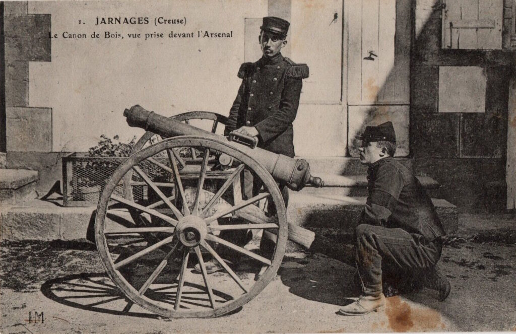
Les Canons de Bois – The Wooden Cannons of Jarnages
During the Hundred Years War (1337–1453), Jarnages was besieged by the English and food supplies were running short. It was suggested that during the night that tree trunks were placed on the walls surrounding Jarnages, hoping the English would mistake them for cannons.
The English fell for it! The siege was lifted.
To honor this, two cannons were made. They were destroyed when once they filled with gunpounder during the Michaelmas festivities.
Jarnages wasn’t stopping there! To prove how mighty they were, they made another wooden cannon and turned it towards various bell towers Including Lamaids (35kms), Toulx-Sainte-Croix and Gouzon. They stuffed it with butter, rotten eggs and white cheese. A replica is on display in the multi-purpose hall in Jarnages.

Co-Ordinates
| System | Datum | X Coordinate | Y-coordinates |
|---|---|---|---|
| Longitude latitude | WGS84 | 46° 10′ 56.417123″N | 2° 5′ 1.038522″E |
| Longitude latitude | WGS84 | 46.1823380896544 | 2.08362181153161 |
| UTM coordinates | WGS84 | 31T 429276.278 5114714.932 | |
| MGRS / UTMREF | WGS84 | 31TDM 29276.278 14714.932 | |
| NAC (Natural Area Coding) | WGS84 | H5684G QNWBHM | |
| W3W (What 3 Words) | English | cooperating.hooter.uppermost | |
| W3W (What 3 Words) | French | chargeant.solfège.clouant | |
| Plus Code (google Open Location Code) | 8FR453JM+WF | ||
| WSG84 Web Mercator | EPSG 3857 | D 990, Mirabelles, Jarnages, Aubusson, Creuse, Nouvelle-Aquitaine, France métropolitaine, 23140, France |
Maps

View on Google Maps